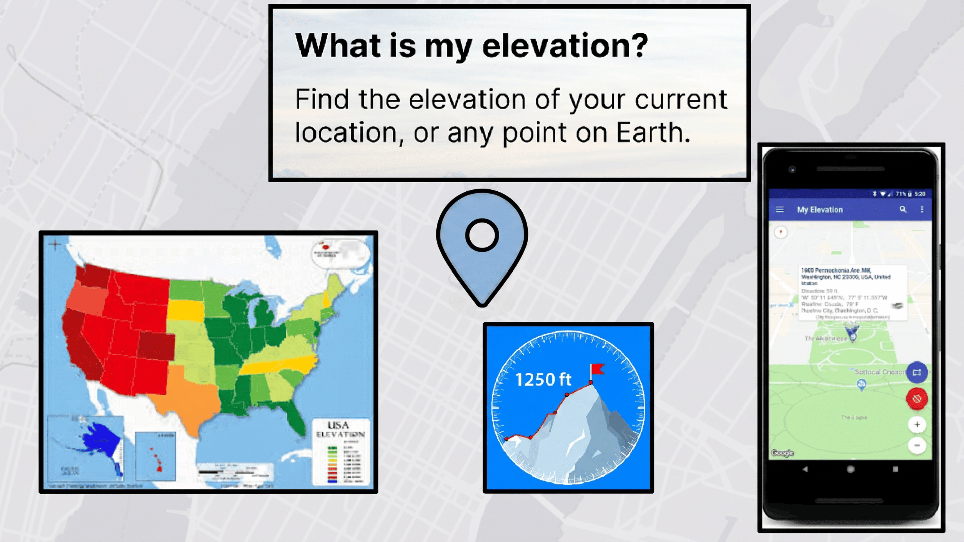
Have you ever wondered how high above sea level you actually are? Whether you are hiking, traveling, or just curious, knowing your elevation matters more than you think.
Finding out what is the elevation at my location is now easier than ever. No special equipment is needed. Just a browser and a few seconds.
The right tool gives you instant, accurate results. It can help with outdoor planning, health awareness, and even understanding the weather.
Get to know the best free online tools to check your elevation, how accurate they are, and simple tips to get the most precise reading every time.
What Is the Elevation at My Location?
The elevation at your location refers to how high your current position is above sea level.
It is measured using GPS data and mapping systems that combine satellite signals and terrain information to estimate height.
When you allow location access on your device, online tools can instantly detect your position and show the approximate elevation.
This value is not always exact, but it provides a close estimate based on your surroundings and the signal’s accuracy. It is commonly used for travel, hiking, mapping, and geographic analysis.
Practical Uses of Finding Your Current Elevation
Understanding your current elevation can be useful in many real-life situations, from travel to professional work.
Go through the list below to explore different practical uses in detail.
- Helps find your exact height above sea level using GPS data
- Useful for hiking, trekking, and outdoor navigation planning
- Supports travel planning in hilly or mountainous areas
- Assists in weather and climate-related studies based on altitude
- Used in construction and land surveying for accurate ground-level information
- Helps students and researchers in geography and environmental studies
- Provides quick location-based elevation without needing maps or tools
What’s My Current Elevation? What Do People Mean by It?“What’s my current elevation?” means the height of your exact location above sea level at the moment. It shows how high or low you are compared to sea level using GPS and map data. People usually ask this to understand their position in terms of altitude for travel, weather, hiking, or general location awareness. |
Best Online Tools or Websites to Detect Current Elevation
Finding your current elevation is easy with online tools that use GPS or allow manual location input. These websites provide quick and reliable height data above sea level.
1. USGS National Map Viewer
The official US government mapping tool that provides highly accurate elevation and topographic data across the United States.
Maintained by the US Geological Survey, it uses professional-grade terrain data collected through federal surveying programs. It is ideal for researchers, engineers, and planners who need reliable elevation information.
Accuracy Rating: 5/5 (Excellent official government-grade data, most accurate available for US locations)
Device Requirement Note: Works on desktop browsers; location services are optional, as manual map navigation is available.
|
How to use:
|
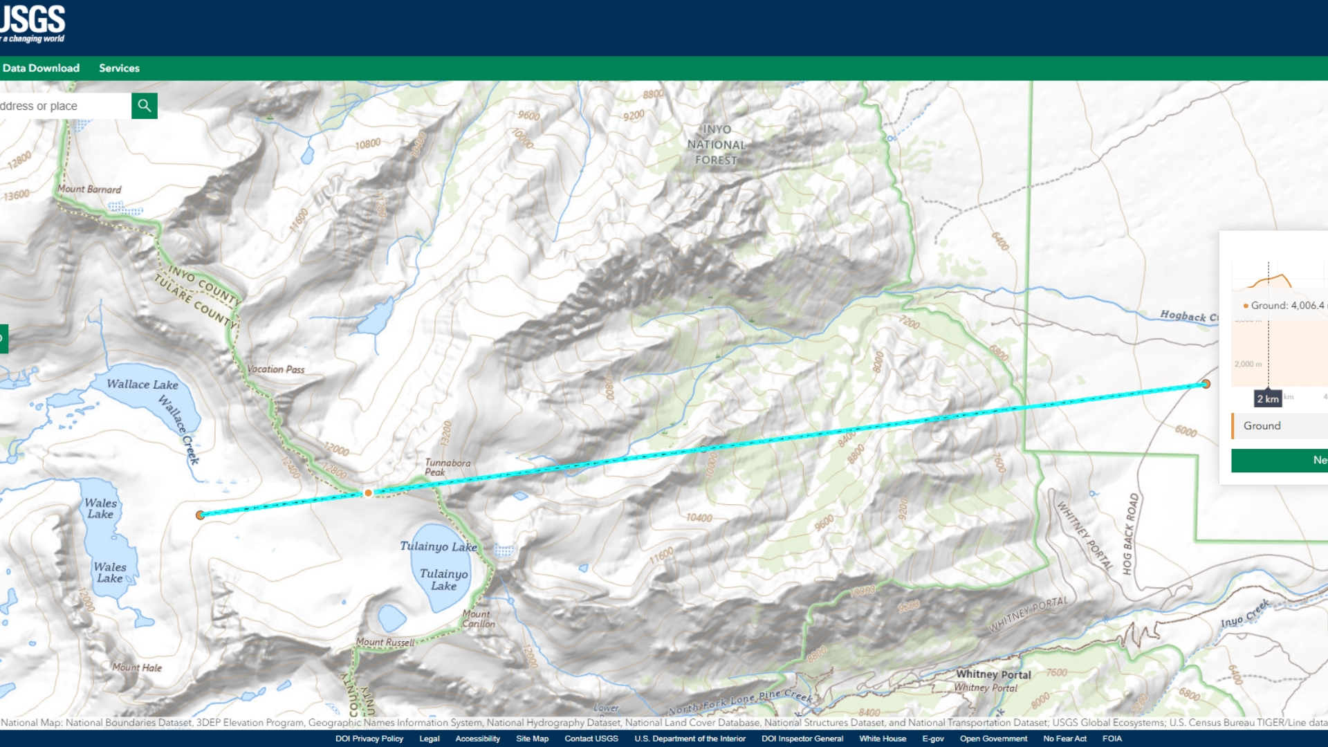
2. USGS Elevation Point Query Service
A precise government tool that returns exact elevation values for any location in the US using geographic coordinates (latitude and longitude).
It queries the National Elevation Dataset directly, making it one of the most accurate point-based elevation tools available. It is best suited for technical users, surveyors, and developers who need exact numerical elevation data.
Accuracy Rating: 5/5 (Extremely precise returns elevation to the decimal point using official federal datasets)
Device Requirement Note: No GPS required; works with manually entered coordinates on any desktop or mobile browser.
|
How to use:
|
3. NOAA Data Viewer

An official US government tool managed by the National Oceanic and Atmospheric Administration, providing elevation and coastal terrain data for the United States.
It is especially strong for coastal, flood-prone, and sea-level-sensitive areas. It is widely used by emergency planners, environmental scientists, and coastal engineers.
Accuracy Rating: 5/5 (Excellent for coastal and low-lying areas; slightly less detailed for inland mountainous regions)
Device Requirement Note: Best used in a desktop browser; no GPS is needed, as the map is fully navigable manually.
|
How to use:
|
4. OpenTopography

A US-supported high-resolution platform that provides access to advanced topographic and elevation datasets, including LiDAR data from across the United States and globally.
It is backed by the National Science Foundation and is used by scientists, researchers, and GIS professionals. It is ideal for users who need detailed terrain analysis beyond basic elevation readings.
Accuracy Rating: 5/5 (Outstanding uses LiDAR and high-resolution DEM data for very precise terrain mapping)
Device Requirement Note: Best used on desktop; no GPS required as datasets are accessed by selecting regions on the map.
|
How to use:
|
5. Google Earth
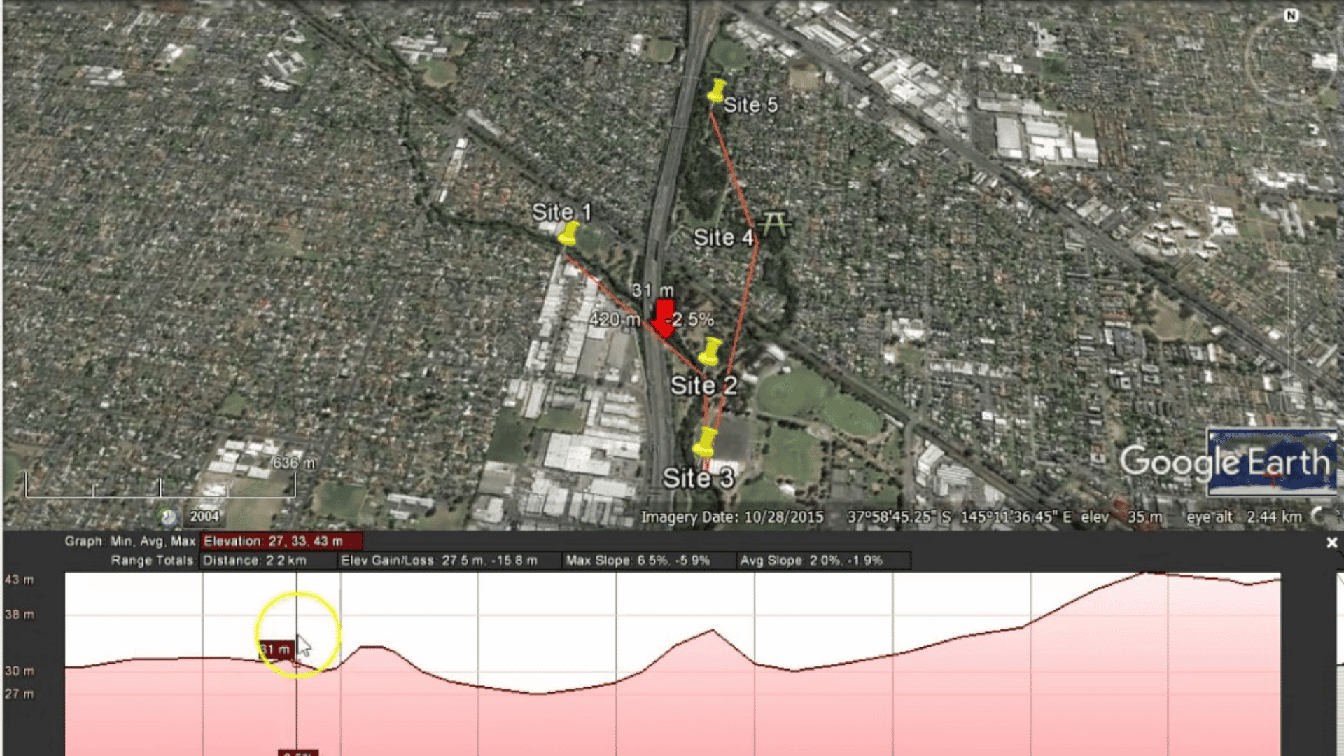
A powerful and visually immersive mapping tool by Google that displays detailed 3D terrain and elevation data for any location on Earth.
It combines satellite imagery, aerial photography, and elevation models to give a realistic view of the landscape. It is widely used by travelers, educators, geographers, and outdoor enthusiasts around the world.
Accuracy Rating: 4/5 (Very good globally; elevation shown in real time as you move the cursor across the map)
Device Requirement Note: Works in desktop browsers via the web version; location services are optional but helpful for quickly jumping to your current location.
|
How to use:
|
6. CalTopo
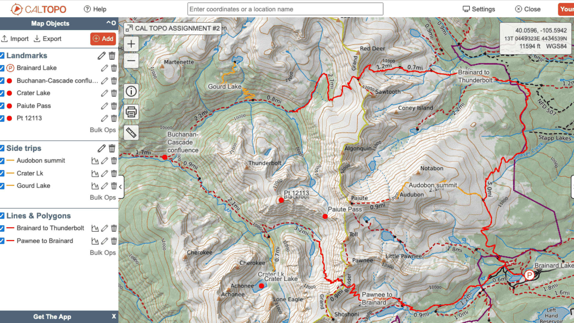
A highly respected US-based mapping and terrain analysis tool popular among hikers, backpackers, search and rescue teams, and outdoor professionals.
It offers detailed topographic maps, elevation profiles, and slope analysis for any location across the United States. It is considered one of the most powerful free mapping tools available for outdoor navigation.
Accuracy Rating: 4.5/5 (Excellent for US terrain, especially strong in wilderness, forest, and mountain areas)
Device Requirement Note: Works on both desktop and mobile browsers; GPS location detection available for real-time tracking.
|
How to use:
|
7. FreeMapTools Elevation Finder
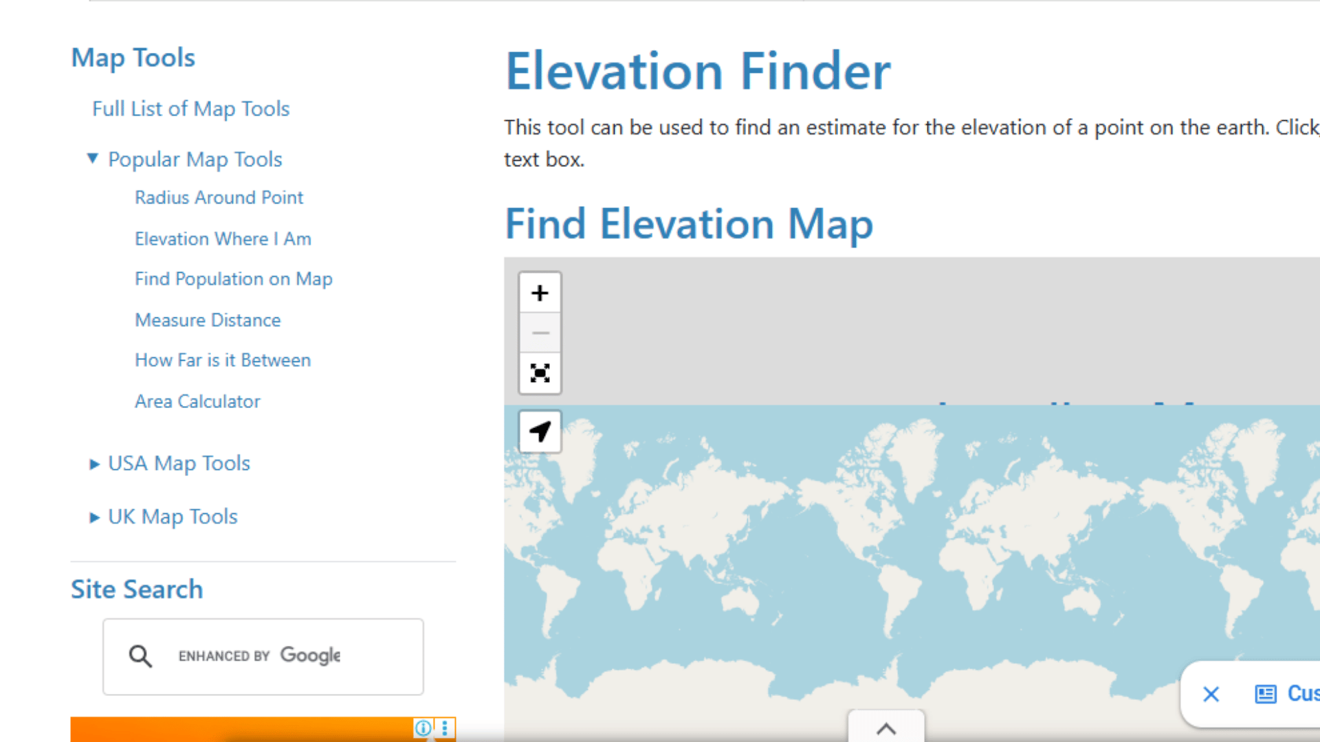
A straightforward and easy-to-use online tool that lets users find the elevation of any location by clicking on an interactive map or entering a specific address.
It is powered by Google Maps elevation data and is accessible without any sign-up or installation. It is great for quick elevation lookups for both US and international locations.
Accuracy Rating: 4/5 (Reliable for general use; powered by Google Maps elevation data, which is consistently accurate)
Device Requirement Note: Works on all desktop and mobile browsers; no GPS or location permission required.
|
How to use:
|
8. WhatIsMyElevation.com
One of the simplest and most beginner-friendly elevation tools available online, designed specifically to give users their current elevation in just a few seconds.
It automatically detects your location using your browser’s GPS and displays your elevation without any extra steps. It is perfect for casual users who want a fast, no-hassle elevation check.
Accuracy Rating: 4/5 (Good real-time accuracy; results depend on GPS signal strength and browser location permissions)
Device Requirement Note: Location services must be enabled on your device for auto-detection to work; manual address search is also available.
|
How to use:
|
How Accurate Are Online Elevation Tools?
Online elevation tools are generally accurate for everyday use, but their precision can vary depending on several factors.
Accuracy is influenced by GPS signal strength, the type of device being used, and whether the location is detected automatically or entered manually.
Internet connection quality can also affect how quickly and reliably data is fetched.
In addition, different tools may use different mapping databases or elevation models, which can lead to small variations in results.
For highly precise measurements, government sources such as the USGS or NOAA are more reliable than basic browser-based tools.
Elevation vs Altitude: What Is the Difference?
Many users confuse elevation and altitude, but both terms refer to different measurements of height. Understanding the difference helps avoid confusion when using maps or GPS tools.
| Term | Meaning | Simple Use |
|---|---|---|
| Elevation | Height of a location above sea level on land | Used for ground level, maps, and terrain |
| Altitude | The height of an object above sea level in the air | Used for planes, drones, and flying objects |
| Key Difference | Elevation is fixed land height; altitude changes with movement | Elevation = ground, Altitude = air |
Tips for Getting the Most Accurate Elevation Reading
Getting an accurate elevation reading depends on how well your device and tools can detect your location.
A few simple steps can help improve accuracy and reduce errors:
- Turn on GPS and location services for better precision
- Use Wi-Fi or mobile data to improve location detection
- Stand outdoors or in an open area for a stronger signal
- Avoid basements, buildings, or covered areas while checking elevation
- Allow location access permission when using online tools
- Refresh or recalibrate the tool if readings seem incorrect
- Use trusted tools like USGS or Google Earth for higher accuracy
Conclusion
Checking your elevation no longer requires expensive equipment or technical knowledge. The tools covered in this guide are free, fast, and easy to use for anyone.
From quick Google searches to detailed government platforms like USGS and NOAA, every need is covered.
Whether you are a hiker, traveler, student, or researcher, there is a tool that fits you perfectly.
Pick the one that suits your purpose and start exploring your surroundings from a whole new perspective.
Bookmark your favorite tool today so it is ready whenever you need it. Try one of these tools right now and discover your exact elevation in seconds.
We would love to hear from you. Drop your elevation reading or favorite tool in the comments below!
Frequently Asked Questions
Can Elevation Change Over Time at the Same Location?
Yes, elevation can change slightly over time due to natural events like earthquakes, erosion, or construction activities. However, these changes are usually very small and not noticeable in daily use.
Do Elevation Tools Work without Internet?
Most online elevation tools require internet because they fetch data from GPS maps or servers. However, some mobile apps with offline maps can show approximate elevation without connectivity.
Why Do Different Tools Show Slightly Different Elevation Readings?
Different tools use different data sources, such as satellite models, GPS signals, or government datasets. This can lead to small variations in elevation results, even for the same location.